 |
 |
||||
| . | . | . | |||
| > World / North America / Canada / Ontario / Toronto | |||||
 |
||||
POPULATION -
|
2,615,050 (2014) | |||
AREA -- |
630 sq km (2016) | |||
WALKSCORE - |
71 (walkscore.com - 2016) | |||
RESTAURANTS - |
8640 (yelp.com - 2016) | |||
HOTELS - |
295 (priceline.com - 2016) | |||
TOURISM - |
Tourism Toronto | |||
OFFICIAL - |
Toronto | |||
WIKIPEDIA - |
Toronto | |||
NUMBEO - |
Toronto | |||
CRAIGSLIST - |
Toronto | |||
REDDIT - |
Toronto | |||
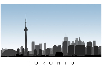
| ... The City of Toronto (originally called York) originated in the late 1700s by British settlers and soldiers. Today, Toronto is Canada's largest city and the capital of the province of Ontario. Toronto sits on the northern shores of Lake Ontario and is well known for its multiculturalism, large finance and business sector, cultural institutions, festivals, sports, and entertainment. Toronto is considered a safe city to live in and work and is considered amongst the highest in the world for quality of life. |
 |
|
| . | |
| . | |
| .. |
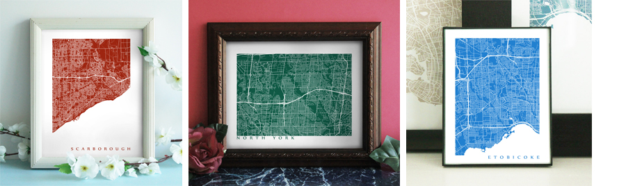
| Toronto - York - East York - North York - Etobicoke - Scarborough | ||
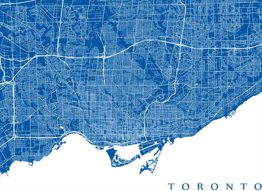
| In 1998 Toronto was amalgamated alongside the boroughs of York, East York, North York, Etobicoke, and Scarborough to create the City of Toronto. Although defunct now, Toronto's former boroughs are still recognized by many people as cities within a city. | ||
| . | . |
|
 |
||
| . | ||
| . | ||
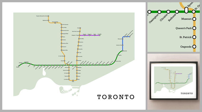
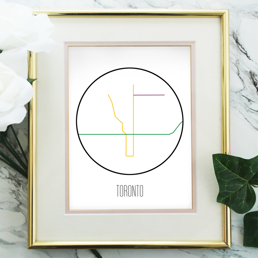
| .. | The Toronto subway, offically known as the Toronto Transit Commission (or TTC) has been operating subways since 1954 and has an annual ridership of over 320 million passengers. | |
 |
|
| . | |
| ... Real world Toronto metro subway design shows the entire TTC subway system with all of the stops. The stations along the Bloor/Danforth line include: Kipling, Islington, Royal York, Jane, Runnymede, High Park, Keele, Dundas West, Lansdown, Dufferin, Ossington, Christie, Bathurst, Spadina, St. George, Bay, Yonge-Bloor, Sherbourne, Castle Frank, Broadview, Chester, Pape, Donlands, Greenwood, Coxwell, Woodbine, Main Street, Victoria Park, Warden, and Kennedy. The Stations along the Yonge/University line include: Finch, Sheppard-Yonge, York Mills, Lawrence, Eglinton, Davisville, St. Clair, Summerhill, Rosedale, Bloor-Yonge, Wellesley, College, Dundas, Queen, King, Union, St. Andrew, Osgoode, St. Patrick, Queen's Park, Museum, St. George, Spadina, Dupont, St. Clair West, Eglinton West, Glencairn, Lawrence West, Yorkdale, Wilson, Downsview, Sheppard West, Downsview Park, Finch West, York University, Pioneer Village, Highway 407, and Vaughan Corporate Centre. The stations along the Sheppard line include: Sheppard-Yonge, Bayview, Bessarion, Leslie, and Don Mills. The stations along the Scarborough RT include: Kennedy, Lawrence East, Ellesmere, Midland, Scarborough Centre, and McCowan. | |
| . | |
 |
|
Scandinavian minimalist style metro maps offer a stylish and simple contemporary chic design that is great for a touch of moden in your home. |
|
 |
| . | |
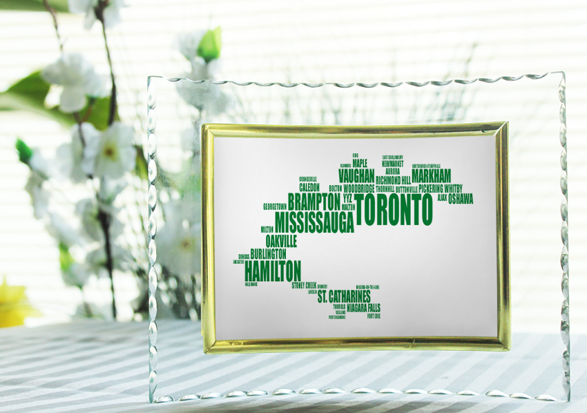
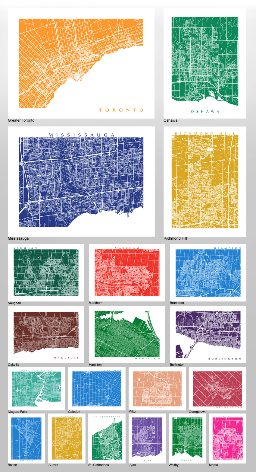
| .. | ... Toronto is the central key city in the Golden Horeshoe area. Named after is arched shape, the Golden Horseshoe wraps around the western shores of Lake Ontario encompassing the City of Toronto, City of Hamilton and regions of Niagara, Halton, Peel, Durham, and most of York. The Golden Horseshoe consists of almost 9 million residents (approximately 26% of the Canadian population) and is considered the economic backbone of the country. Some of the various cities and towns that surround Toronto in the Golden Horseshoe include: Mississauga, Oshawa, Richmond Hill, Brampton, Vaughan, Markham, Hamilton, Oakville, Burlington, Niagara Falls, Caledon, Milton, Georgetown, Bolton, Aurora, St. Catharines, Ajax, Whitby, Maple, Pelham, Uxbridge, King City, Niagara-on-the-Lake, Ancaster, Dundas, Stoney Creek, Waterdown, and Acton. |
 |
|
 |
|